Core strengths
Computational agronomy, geospatial analytics, remote sensing, machine learning, scalable data infrastructure
Digital Intelligence for Agriculture
We help agricultural enterprises, millers, and public institutions connect field, operational, environmental, and satellite data in one structured environment for planning, forecasting, and faster response to risk.
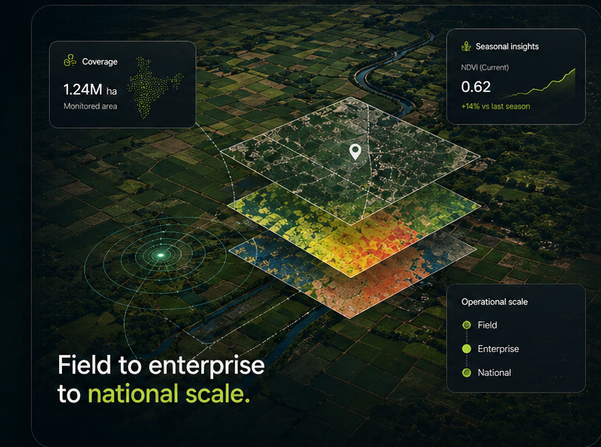
Designed to work from individual fields and production zones through to multi-site operations and national agricultural programs.
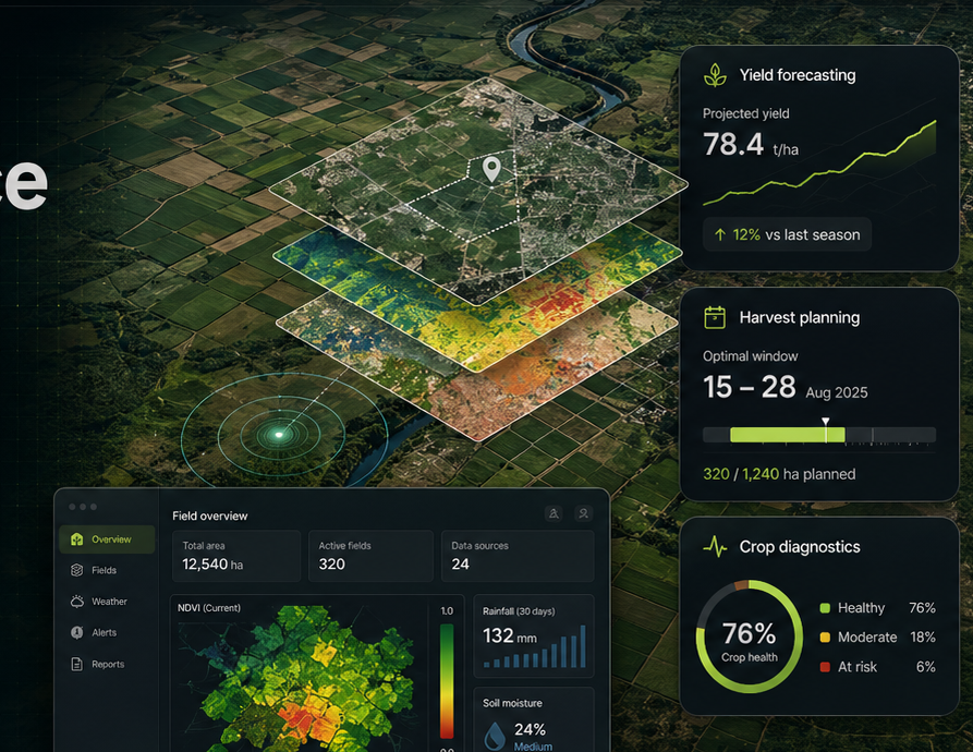
Support estate- and enterprise-level visibility, planning, forecasting, harvest optimisation, and operational response across large agricultural footprints.
About STL Technologies
STL Technologies combines computational agronomy, geospatial analytics, remote sensing, software engineering, machine learning, and scalable cloud infrastructure to solve practical agricultural problems.
Computational agronomy, geospatial analytics, remote sensing, machine learning, scalable data infrastructure
Agricultural data, analytics, and decision-support systems
Agricultural enterprises, millers, governments, public-sector institutions
Field level, enterprise level, national level
Solutions
We deliver field-level visibility, data integration, forecasting, diagnostics, and decision-support systems that improve planning and response across agricultural operations.
Use cases across the value chain
Combine crop-specific models, satellite time series, and operational data to estimate likely field performance months ahead of harvest.
Capabilities & Approach
From forecasting models and geospatial intelligence to cloud-free monitoring and scalable data infrastructure, the platform is designed for decision-making in the field and at leadership level.

How we work
Design and implement the required data products, analytics, and decision-support systems around the client's real planning workflow.
Better outcomes come from connecting fragmented data, not adding another standalone tool.
Models reflect the biology and operating reality of each crop.
Built for planning, execution, and management use, not only reporting.
Architecture supports enterprise and public-sector use cases.
Client teams build internal capability for long-term success.
Applied across different geographies, crops, and operating conditions.
Commercial Approach
We structure engagements around scope, hectares, integration needs, analytics requirements, and the level of capability transfer required — aligning commercial structure with clear objectives, milestones, and measurable value delivery.